Sander Berghmans recently obtained his PhD in History and Applied Economic Sciences at Ghent University. In his dissertation, he investigates how large landowners in the Southern Netherlands managed their estates between 1600 and 1820, and how their decisions influenced both the economy and society.
Through various case studies, he demonstrates how these landowners, such as the Dukes of Arenberg and the abbots of Roosewalle and Ename, maximized their profits through strict management, financial strategies, and by excluding smaller farmers.
Their choices significantly impacted the local population and broader economic developments. Berghmans applies economic theories, such as principal-agent theory, to better understand these practices and advocates for greater attention to historical context in economic research.
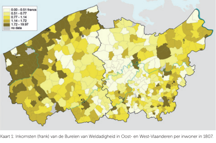
Researchers at the Quetelet Center contributed to the project by producing maps that illustrate, among other things, the distribution of large landholdings.
Publication:
Sander Berghmans. Dukes and Abbots: Essays on the Economics of Estate Management in the Southern Netherlands (ca. 1600-1820). Ghent, PhD Dissertation, 2025.
DETAILS
Database used: STREAM & LOKSTAT
Date: March 2025
Category: Scientific publication