DETAILS
Used database
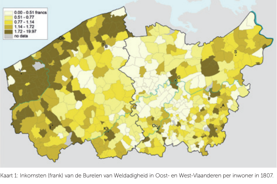
BETHUNE
Date:
October 2017
Category:
Scientific publication
SAMPLING SELECTION TECHNIQUE BRINGS ORDER TO THE CHAOS
In the BETHUNE database, you can find the sales invoices of the textile company Bethune & Fils. The database was created as part of the doctorate of Annik Adriaenssens: “Van laken tot linnen. De textielhandel Bethune & Fils. Tweede helft achttiende eeuw. Een analyse op basis van het bedrijfsarchief” (“From cloth to linen. The textile trade of Bethune & Sons. Second half of the eighteenth century. An analysis based on the company archive”). For their research, Coessens and Heirman got to work on the sales invoices created between 1737 and 1799, which were included in the database.
Read the full chapter (in Dutch):