Food deserts in Flanders

DETAILS

Used database:

LOKSTAT

Date:

March 2019

Category:

Doctoral defence

FOOD DESERTS IN FLANDERS

On 6 March, Jeroen Cant (Antwerp University, Faculty of Applied Economic Sciences) defended his doctoral thesis on the accessibility of food stores in Flanders and the spatial mismatch between food retailing and residential structures.

In the past, food stores were embedded in residential areas. However, the rise of monofunctional urban development has led to living and shopping becoming separated, resulting in an increasing dependence on the car. People who are less mobile or live in isolated areas and do not have a car consequently have difficulty accessing food stores. Jeroen Cant warns of the emergence of food deserts, neighbourhoods in urban centres with little or no access to affordable and varied food.

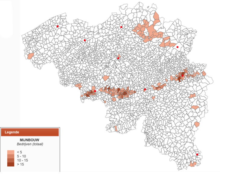
The study is based on an extensive data analysis of food stores since 1962, in which the LOKSTAT database played a part.

Abstract

“This dissertation explores whether food retail inaccessibility has established itself in Flanders. To investigate this a mixed methods methodology is applied. First, a theorization on how inaccessibility can occur even in highly developed nations is provided, based on a comprehensive literature review. Historically retail has been embedded in residential structures. Monofunctional development patterns in Fordist and post-Fordist times, however, have led to a severe unbundling of living and shopping, resulting in an increased need for automobility. Those with reduced personal mobility rates due to socioeconomic or physical reasons are confronted with inaccessibility because of this spatial mismatch.

Retail policy, however, has been shown to temper unbundling trends, particularly when it is embedded in spatial planning and applied on a national/federal level. In Flanders, policy was based on socioeconomic restrictions with the municipalities in the driver’s seat. Descriptive statistics then show important retail-residential unbundling trends in the region. The relationship between food retail floor space and the residential is further investigated using Geographically Weighted Regression (GWR).

Large supermarkets and hypermarkets have clearly sprawled away from residential structures, though the network of traditional, specialized retailers is still embedded. Big shops, however, increase consumer utility through lower prices and larger assortments. An address level network analysis shows that basic accessibility, or the ease of reaching a food opportunity with a full variety regardless of attractiveness, has been maintained in cities and in town centers through a network of both traditional stores and small supermarket formulas.

Since poverty has sedimented in the urban core, basic inaccessibility due to socioeconomic reasons (i.e. food deserts) remained limited and highly contextualized in outer city modernist housing estates, garden cities and industrial areas. Said small food store network never established itself in the affluent monofunctional neighborhoods that characterize urban sprawl in Flanders, leading to high local travel distances. As historically personal mobility rates were high here, actual inaccessibility remained limited for a long period of time. Currently, however, these areas are confronted with important aging trends, and issues will start manifesting themselves. Given the prevailing socio-spatial evolutions, both the unbundling of large-scale food retailing and the residential, and growing inaccessibility in the suburbs are expected to rise further in the near future if not in some way combated.”


How much did a midwife earn?

DETAILS

Used database:

LOKSTAT

Date:

February 2019

Category:

Scientific publication

HOW MUCH DID A MIDWIFE EARN?

Christa Matthys used the casebook of the midwife Joanna Mestdagh to investigate how much a 19th-century rural midwife earned and which factors determined her wages. Among the sources that Matthys consulted was the LOKSTAT database, which she used for the birth rates of Dudzele in West Flanders, where Joanna Mestdagh was active, and the average wage of a day labourer in this region.

Article:

Matthys, Christa. “Pay the midwife! The cost of delivery in nineteenth-century rural West Flanders: the case of midwife Joanna Mestdagh”. TSEG/The Low Countries Journal of Social and Economic History 15, no. 2–3 (2018): 5–32.

Abstract: 

“This article focuses on the determinants of the economic cost of at-home childbirth in Flanders in the nineteenth century. Literature on the remuneration of medical professionals in the nineteenth century is sparse. Yet the few existing studies show that fixed rates per delivery did not exist during the nineteenth century. Before that time, pricing was influenced by factors such as the professional experience of the midwife, the distance between the residence of the midwife and the client, the social status of the client and the specific circumstances of the client’s condition. I analyze these factors with regard to home births that were assisted by a certified midwife, using the casebook of a rural Flemish midwife for the period 1831-1892.”


POPPKAD in demand

DETAILS

Used database:

POPPKAD

Date:

February 2019

Category:

Database

POPPKAD, the database of the Belgian cadastre from the 19th century, is reaching a wide audience. According to the latest usage statistics, more than 3 000 researchers, local historians, genealogists and interested parties have used POPPKAD. Hundreds of them even consult the research infrastructure on a regular basis. In particular, the database of property owners from the mid-19th century is being heavily consulted. The names of 540 000 owners in more than 1000 Belgian municipalities can be searched on the POPPKAD website. The search queries are headed by – somewhat predictably –  the surnames Peeters, Janssens and Desmet. The website also provides access to scans of the original cadastral registers, which combine more information about property owners, buildings and land in the 19th century. According to preliminary figures, more than 15 000 registers have already been downloaded through the website.

Deaf and vulnerable?

DETAILS

Used database:

DEAF

Date:

December 2018

Category:

Publication

DEAF AND VULNERABLE?

Read the full article or use the DEAF database yourself. 

Article:

De Veirman Sofie, and Isabelle Devos. “Tussen familie en instelling? Een analyse van de huishoudtrajecten van doven in Oost-Vlaanderen, 1750-1950.” Belgisch Tijdschrift voor Filologie en Geschiedenis/Revue Belge de Philologie et Histoire (“Between family and institution? An analysis of the household trajectories of deaf people in East Flanders, 1750-1950.” Belgian Journal of Philology and History) 95 (2017): 799–832. 

Abstract

“Disability scholars assume a social segregation process for persons with disabilities in the nineteenth century. In pre-industrial times, disabled persons were considered the main responsibility of family and kin. When traditional kinship ties failed and individualism increased in the nineteenth century, the responsibility had to be taken over by institutions. Because of the difficulties in identifying people with an impairment in historical sources and the time-consuming nature of life course data collection this segregation hypothesis has never been empirically tested. Reconstructing the household trajectories of deaf men and women, we examine in this article the role of family in the lives of people with a disability and if this relationship changed during the nineteenth century. Based on our analyses, we argue that the nineteenth-century evolution from informal to formal care needs revision. Throughout the eighteenth and nineteenth century, family continued to play an important role in the lives of deaf people. Moreover, co-resident deaf persons were not merely care receivers, but actively contributed to the family economy. The personal life stories of institutionalised deaf men and women suggest that institutionalization was to an important extent determined by the pool of available kin, and not necessarily the result of the unwillingness of family to take in a deaf relative. This article shows that the idea that deaf people – and by extension people with disabilities – were vulnerable by definition, at least with regard to their living situations and role within the household, needs revision.” 

Hungry Belgium

DETAILS

Used database:

LOKSTAT

Date:

January 2019

Category:

Scientific publication

HUNGRY BELGIUM

Read the full article or consult the LOKSTAT website.

Article:

Ronsijn, Wouter, and Eric Vanhaute. “From the hungry 1840s to the dear 1850s: the case of Belgium’s food price crisis, 1853-56”. Agricultural History Review 66, no. 2 (2018): 238–260. 

Abstract

“This paper investigates the 1853–56 food crisis in Europe. It argues that this was not a classic famine triggered by a far-reaching decline in food availability. Instead, it was one of the first instances of a ‘food price crisis’ on an international scale: a crisis instigated by high prices obstructing access to food for large parts of the population. This crisis stemmed from new forms of vulnerability resulting from the internationalization of supply chains, the proletarianization of labour and the commercialization of goods and services. As such, it mainly affected market-dependent urban populations. We conclude by drawing parallels with the contemporary global food system.” 

New database on urban mortality available!

DETAILS

Used database:

HISSTER / URBAN DEATHS

Date:

December 2018

Category:

Database

NEW DATABASE ON URBAN MORTALITY AVAILABLE!

The URBAN DEATHS database was created by Tina Van Rossem as part of her doctoral project “Bruxelles ma belle. Bruxelles mortelle: an investigation into excess mortality in Brussels at the turn of the twentieth century.”

Tina Van Rossem started work on the individual death certificates from Brussels, Liège and Schaerbeek from the year 1910. She collected not only details of the date and place of death of all the deceased, but also data on their occupation, age at death and the witnesses who signed the death certificate. This means the database is an ideal source for anyone interested in average ages at death, occupational structures and high-risk neighbourhoods in these cities.

Interested in using this database yourself? Then contact the staff at the Quetelet Center or check out the URBAN DEATHS page.

Make historical maps yourself on the LOKSTAT website

DETAILS

Used dataset:

LOKSTAT

Date:

October 2018

Category:

Tool

MAKE HISTORICAL MAPS YOURSELF ON THE LOKSTAT WEBSITE

Of all the industrial censuses that have ever taken place in Belgium, the one of 1896 occupies a special place. It was the first census that gave a fairly reliable overview of the various industries in all the localities of the country. If you are looking for solid information about local industries, cottage industries in rural areas, old occupations that no longer exist or searching for data on the economic development of Belgium, you will find just what you need in this source. 

The census results can be consulted per municipality as well as per industrial sector. Moreover, the tables can also be visualised spatially using a map program developed by the Department of Geography of Ghent University. Thanks to this application, the reader can make numerous maps of the distribution and employment in the following industries:

  • mining 
  • quarrying
  • metal industry,
  • ceramic industry
  • glass industry
  • chemical industry
  • food industry
  • textile industry
  • clothing industry
  • construction industry
  • wood and furniture industry
  • leather and skin industry
  • tobacco industry
  • paper industry
  • book industry
  • arts and precision industry
  • transport


The image below shows the distribution of mining companies across the whole of Belgium. What is remarkable are the many small open-cast firms that mined iron in the Campine area around 1900. Moreover, numerous more specific applications are also possible.

Curious about where in the country roof tiles were made or cameras were produced? Would you like to know how many people were employed in the diamond industry or how many men and women were engaged in decorative ceramics? Dive into the application yourself and search for the data that are useful for your research! 

Contact the Quetelet Center to start working with other data series from the LOKSTAT database!

Doctoral defense of Tina Van Rossem

DETAILS

Used dataset:

URBAN DEATHS

Date:

September 2018

Category:

Doctoral defense

DOCTORAL DEFENSE OF TINA VAN ROSSEM

The public defense takes place at the Humanities, Sciences & Engineering campus of the Vrije Universiteit Brussel (VUB), in building D, in the ‘promotiezaal’ auditorium D. 2. 01.

Article:  

Van Rossem, Tina. “Bruxelles ma belle. Bruxelles mortelle: an investigation into excess mortality in Brussels at the turn of the twentieth century”. PhD dissertation, Vrije Universiteit Brussel-Ghent University, 2018. 

Abstract

“This research focuses, from a comparative perspective, on the excess mortality that was observed by contemporaries in Brussels in the late nineteenth and early twentieth century, and on the relationship with employment and living conditions. An analysis of quantitative sources using demographic, statistical and spatial techniques is combined with text analyses of qualitative source material. The results show that in Brussels in 1910, life expectancy at birth was 41 years, which was 10 years lower than the national average. The differences with other large cities in Belgium were 5 years or more. The mortality rates of men and women of all ages were high during the Belle Époque in Brussels, but the biggest disadvantage was found for children and adult men. The main causes of death were enteritis for infants, respiratory diseases for children and pulmonary tuberculosis for adult men.

The analyses suggest a strong positive relationship between excess mortality and the dominance of small-scale businesses and cottage industries in Brussels. There were no labour regulations for cottage industries, and homeworkers worked in very dangerous conditions. The situation was probably not much better in artisan workshops and small-scale factories, where trade unions were weak or non-existent. Moreover, the many urban transformation projects in Brussels from the mid-nineteenth century onwards had drastically reduced the living space for the working class. This had caused very high levels of overcrowding in the city. The analyses at the individual level particularly demonstrate that there were major inequalities in the average lifespan of adults, depending on living conditions. The worst conditions were found in the lower lying locations in the southwest of Brussels. Despite the early installation of a water supply network in Brussels, the high levels of enteritis among infants also surprisingly show an additional negative effect of the sanitary conditions.

During the Belle Époque, large-scale redevelopment had created prestigious neighbourhoods, but at the same time the working class was confronted with dangerous working conditions and driven to overcrowded neighbourhoods. The result was that many of them died at a young age.”

Civil courts in the Franc of Bruges

DETAILS

Used dataset:

STREAM

Date:

June 2018

Category:

Doctoral defence

CIVIL COURTS IN THE FRANC OF BRUGES

Vervaeke, Ans. “Met recht en rede(n). Toegang en gebruik van burgerlijke rechtbanken in het Brugse Vrije (1670-1795)” (“With good reason(s). Access and use of civil courts in the Franc of Bruges (1670-1795)”). PhD dissertation, Vrije Universiteit Brussel-Ghent University, 2018. 

Was it more dangerous to work at home or in a factory?

DETAILS

Used dataset

HISSTER

Date:

December 2017

Category:

Scientific publication

WAS IT MORE DANGEROUS TO WORK AT HOME OR IN A FACTORY?

Tina Van Rossem, Patrick Deboosere and Isabelle Devos set to work with the population figures and mortality rates from the HISSTER database. The database contains mortality statistics at the local and regional level, going back to 1841.

Article

Van Rossem, Tina, Patrick Deboosere, and Isabelle Devos. “Death at work? Mortality and industrial employment in Belgian cities at the turn of the twentieth century”. Explorations in Economic History 66 (2017): 44–64.

Abstract

“In this article, we reconstruct the sex- and age-specific mortality rates for the 25 largest Belgian cities at the turn of the twentieth century, and we explore their relationship with industrialization. Whereas previous research has focused mainly on the general level of industrial employment, we make a distinction between two production systems: cottage work (i.e., employment at home) and regular industrial production (i.e., centralized employment). Our linear regression models suggest that cities oriented toward cottage industry were more lethal than those oriented toward regular industry. Cities where a substantial percentage of the labor force was engaged in cottage work suffered high mortality rates, which confirms contemporary claims that in Belgium the cottage industry was “the most murderous of all industries.” Regular industrial employment, on the other hand, appears to have been less harmful for men and women alike, both young and old. We do observe, however, a detrimental effect from female regular industrial employment on infant and child mortality. Using contemporary government reports and sociological works, we were able to gain insights into the possible pathways that created these large health discrepancies between production systems. We argue that the health hazards encountered by cottage workers were due to the absence of labor and wage regulations and to the lack of health and safety standards in cottage work. In many sectors of the regular industry—and in heavy industry in particular—numerous regulations of this type had already been enforced by emerging labor union organizations, resulting in improvements in working conditions and higher wages. Furthermore, regular heavy industry seems to have attracted the healthiest workers.”

Did smallpox make you small?

DETAILS

Used datasets:

LOKSTAT & STREAM

Date:

August 2018

Category:

Scientific publication

DID SMALLPOX MAKE YOU SMALL?

For their study, Ans Vervaeke and Isabelle Devos consulted the LOKSTAT database for figures from the 19th-century population census for Thielt and the STREAM database for socio-professional information for the 18th century. Their results show that the effect of smallpox on height, in contrast to that of family circumstances, is not statistically relevant.

Article

Vervaeke, Ans, and Isabelle Devos. “Much ado about nothing? Reconsidering the smallpox effect. Height in the nineteenth-century town of Thielt, Belgium”. TSEG/ The Low Countries Journal of Social and Economic History 14, no. 4 (2018): 56–83. 

Abstract

“Anthropometric evidence such as height has been considered a major indicator of the social and economic well-being of past societies. To understand differences in attained height, the role of several determinants has been widely discussed. Since the 1990s, the impact of disease has shown to be a promising topic. In particular, research on the effect of smallpox on the height of the population in nineteenth-century England has triggered heated debate. Voth and Leunig argue that smallpox stunted height, but their results have been called into serious question by scholars such as Oxley, Razzell, Heintel and Baten. In this article, we introduce new sources and evidence for Thielt, a small rural town in Belgium. By linking military registers with smallpox listings, our analysis allows for a nuanced study of the height of conscripts. In early nineteenth-century Thielt, height differences between smallpox survivors and those who did not fall prey to the disease appear to be largely the result of household circumstances. By taking into account individual and familial attributes, we show the importance of the father’s death and father’s occupation for the son’s height. However, smallpox did not have a statistically significant effect on height.”


The LOKSTAT data applied at the local level

DETAILS

Used dataset:

LOKSTAT

Date:

July 2018

Category:

Publication

THE LOKSTAT DATA APPLIED AT THE LOCAL LEVEL

Based on the agricultural census of 1895 and the industrial census of 1896, Pieter Neirinckx wrote two articles about the economic development of Genk. These publications are just one example of what local historians can achieve with the rich range of data that the Quetelet Center has made available online.

Make your own maps based on the industrial census of 1896, view data tables from the agricultural census of 1895 or from the population census of 1900. The Quetelet Center also manages other data series from the LOKSTAT database which are available to researchers.

Articles: 

Neirinckx, Pieter. “De landbouw in Genk aan het einde van de 19de eeuw”. Tweemaandelijks tijdschrift van de Heemkring Heidebloemke Genk (“Agriculture in Genk at the end of the 19th century”. Bimonthly magazine of the local history society Heemkring Heidebloemke Genk) 77, no. 2 (2018): 34–36. 

Neirinckx, Pieter. “De Genkse industrie aan het einde van de 19de eeuw”. Tweemaandelijks tijdschrift van de Heemkring Heidebloemke Genk (“Genk industry at the end of the 19th century”. Bimonthly magazine of the local history society Heemkring Heidebloemke Genk) 76, no. 2 (2017): 20–22. 

A green revolution in the 18th century?

DETAILS

Used database:

POPPKAD

Date:

October 2018

Category:

Publication

A GREEN REVOLUTION IN THE 18TH CENTURY?

Read the full article or consult the POPPKAD website.

Article:

De Graef, Pieter. “A Green Revolution from below? A social approach to fertiliser use in eighteenth-century Flanders”. Continuity and Change 32, no. 3 (2017): 379–410.

Abstract:

“Profound changes in output and productivity characterised eighteenth-century agriculture, both in regions of large-scale capitalist farming and smallholding cultivation. Aggregate, macro-level studies offer valuable insights, but often prove unable to explain yield increases. Therefore, this article proposes a social approach to agricultural production through a micro-level analysis of fertilisation strategies, taking the smallholding economy of inland Flanders as a starting point. The household perspective demonstrates that a green ‘fertiliser’ revolution with increasing levels of fertilising intensity and off-farm nutrient inputs was instigated from below on both small and large holdings as a response to the broader economic and societal situation.”

Researchers from the Université Catholique de Louvain use the LOKSTAT database

DETAILS

Used database:

LOKSTAT

Date:

November 2018

Category:

Publication

RESEARCHERS FROM THE UNIVERSITE CATHOLIQUE DE LOUVAIN USE THE LOKSTAT DATABASE

Annalisa Frigo and Eric Roca investigated the effect of the presence of beguines in certain Belgian municipalities on contemporary gender relations. Read about their findings in the paper or start working with data from the LOKSTAT database yourself.

Article:

Frigo, Annalisa, and Eric Roca. “Roots of gender equality: the persistent effect of beguinages on attitudes toward women”. Labour Seminar Paper, Milan Bocconi University, 2018.

Abstract: 

“This paper is concerned with the historical determinants of gender equality. In the specific context of Belgium, it relates higher levels of gender equality during the 19th century to the presence of medieval, female-only, Belgian communities called beguinages. Combining a novel, hand-collected data-set on beguinage location with 19th-century Belgian census data, we document that in municipalities where beguine communities settled the literacy gap reduced. Schooling was not compulsory and literacy differentials reflect parental tenets on gender equality. Using changes in the political organisation through which some villages became more attractive to beguines, we establish that the variation in gender literacy is indeed related to the presence of beguinages. Our results are in line with the extensive empirical evidence documenting the persistence of gender norms and culture. Finally, we propose a novel class of mechanisms, based on improvements in girls’ bargaining power, to rationalise our findings”

Unique historical database on persons with disabilities available!

DETAILS

Used database:

DEAF

Date:

2018

Category:

Database

UNIQUE HISTORICAL DATABASE ON PERSONS WITH DISABILITIES AVAILABLE!

The DEAF database was created as part of the doctoral project of Sofie De Veirman, entitled “Breaking the silence. The experiences of the deaf people in East Flanders (1750-1950)”, and forms part of what is known as ‘disability history’, the history of people with disabilities.

The database contains the life-course data of deaf men and women born in East Flanders and offers an insight into the family structures of deaf people, their occupational activities and their living conditions.

Are you interested in studying what the lives of deaf persons were like? Or do you want to look into whether their living conditions changed over time? Then contact us at the Quetelet Center to start working with the data yourself.

Organic urban waste as fertiliser in agriculture

DETAILS

Used database:

LOKSTAT & POPPKAD

Date:

2017

Category:

Scientific publication

ORGANIC URBAN WASTE AS FERTILISER IN AGRICULTURE

In his article, Pieter De Graef questions the historical examples of closed cradle-to-cradle systems, which are put forward by ecological historians as forerunners of current closed nutrient cycles. By using agricultural censuses and cadastral statistics from the LOKSTAT and POPPKAD databases, he calculated how much fertiliser was produced in the different regions of Belgium and shows that there were no closed nutrient cycles.

Article:

De Graef, Pieter. “Food from country to city, waste from city to country: an environmental symbiosis? Fertiliser improvement in eighteenth-century Flanders”. Journal for the History of Environment and Society 2 (2017): 25–61.

Abstract:

“Alternative approaches to resolve bottlenecks in food production often champion the reuse of urban organic waste as fertiliser in agriculture in order to close the nutrient cycle between city and country (cradle to cradle). References are often made to the past because environmental historians tend to work the use of urban wastes into a story of environmental symbiosis between city and countryside. This article argues, however, that closed nutrient cycles did not exist even in pre-industrial society, as the way in which agriculture was structured had a huge impact on the demand for manure. Starting from two agricultural regions in eighteenth-century Flanders, this research calls for more attention to regional structures of agriculture in which cities were embedded and to how these agro-systems shaped nutrient flows from the city to the country by very diverse patterns of demand for fertilisers, leading to unequal redistributive flows of nutrients from towns to different agricultural regions.”

What does STREAM have to offer you?

DETAILS

Used database:

STREAM

Date:

2018

Category:

Database and scientific publication

WHAT DOES STREAM HAVE TO OFFER YOU?

Check out the STREAM website or the STREAM database page to gain an insight into the sources that were processed in the database and how the historical geographic information system was constructed. Want to know more? Then contact the Quetelet Center to start working with the datasets yourself.

Article

Devos, Isabelle, Torsten Wiedemann, Ruben Demey, Sven Vrielinck, Thijs Lambrecht, Philippe De Maeyer, Elien Ranson, Michiel Van den Berghe, Glenn Plettinck en Anne Winter. (2018), “STREAM. A spatio-temporal research infrastructure for early modern Flanders and Brabant: sources, data and methods”, International Journal of Humanities and Arts Computing 12, nr. 2 (2018): 102-119.

Abstract:

“This article presents the technical characteristics of the Belgian STREAM-project (2015- 2019). The goal of STREAM is to facilitate and innovate historical research into local and regional processes through the development of a spatiotemporal infrastructure for early modern Brabant and Flanders, two of the most urbanized and developed areas of pre-industrial Europe. To this end, STREAM systematically collects a range of key data from a diversity of historical sources to provide a geographically comprehensive and long-run quantitative and spatial account of early modern society at the local level (parishes, villages, towns) regarding territory, transport, demography, agriculture, industry and trade, related to the development of a tailored historical geographical information system (GIS) based on the well-known Ferraris map (1770-1778). This article discusses the possibilities and pitfalls of the data collection and the construction of a spatial infrastructure for the pre-statistical era.”

Database on single women in the early modern period available!

DETAILS

Used database:

SINGLE

Date:

2018

Category:

Database

DATABASE ON SINGLE WOMEN IN THE EARLY MODERN PERIOD AVAILABLE!

The SINGLE database was created by Sofie De Langhe as part of her doctoral project, entitled “Oude vrijsters: bestaansstrategieën van ongehuwde vrouwen op het Brugse platteland, late 18de-begin 19de eeuw” (“Old maids: survival strategies of unmarried women in the Bruges countryside, late 18th-early 19th century”).

Sofie De Langhe built an impressive database with the life-course data of never-married rural women living in the Franc of Bruges in the 18th and 19th centuries. She collected biographical and other data on unmarried women from population censuses, parish registers, civil registers of births, marriages and deaths, and numerous other sources.

The database is useful for anyone looking for information about gender relations, property structures and household compositions. Contact the Quetelet Center or check out the SINGLE database page.

The Ferraris map vectorised: the development of a new GIS tool

DETAILS

Used database:

STREAM

Date:

2018

Category:

Scientific publication

THE FERRARIS MAP VECTORISED: THE DEVELOPMENT OF A NEW GIS TOOL

The 18th-century Carte de Cabinet of Joseph de Ferraris is one of the most important historical maps of Belgium. The map is a unique source due to the many topographical elements that are represented in detail on the original sheets. In order to use these valuable data for research purposes, they must be redrawn and converted into editable tables. The STREAM team has developed tools for doing this labour-intensive work in a structured and efficient way. All the roads, waterways, buildings, boundaries and other elements on the map are meticulously redrawn with these tools and placed in an extensive vector file. This file is then enriched with a wide range of historical data, including data on the population, agriculture and industry. The result is a vast collection of geographical data that makes pioneering spatio-temporal research possible. Would you like to see a historical source or census in map form? Then be sure to contact the staff at the Quetelet Center to discuss what the possibilities are.

Article:

De Maeyer, Philippe, Elien Ranson, Kristien Ooms, Karen De Coene, Bart De Wit, Michiel Van den Berghe, Sven Vrielinck, Torsten Wiedemann, Anne Winter, Rink Kurk, and Isabelle Devos. “User-Centered Design of a Collaborative, Object Oriented Historical GI-Platform”. In Dissemination of Cartographic Knowledge: 6th International Symposium of the ICA Commission on the History of Cartography, 379–90. Springer, 2018.


Abstract: 

“The project STREAM (Spatio-Temporal Research Infrastructure for Early Modern Flanders and Brabant) aims to create a research infrastructure that will allow spatio-temporal analyses in order to improve our understanding of the demographic, social and economic changes that occurred in Flanders and Brabant (Belgium) between 1550 and 1800. The Carte de Cabinet of count Joseph de Ferraris (1771–1778) offers information on various subjects for that time period and is considered one of the most important products of Belgian cartographic history. Hence this historical map was used as the main source document to develop a vectorial geographical database that constitutes an important step towards the creation of a research infrastructure. To build this geographical database a retrogressive method was used in order to interpret the historical map and its related data in an absolute geographical reference system, which the Carte de Cabinet lacks. Since STREAM results from a collaboration between researchers from different disciplines a specific user-oriented editing platform was developed to support the different actors. This platform allows the digitisation of the historical road network in a geographic reference system based on the current road network by means of a slider, a shift tool and an editing tool. Initial analyses have confirmed the strong geometric distortions of the Carte de Cabinet but also the multiple possibilities for spatio(-temporal) research when combining the information of the Carte de Cabinet with cartographic analyses of other cartographic documents.” 

Neuroscientists get to work with LOKSTAT data

DETAILS

Used database:

LOKSTAT

Date:

2018

Category:

Publication

NEUROSCIENTISTS GET TO WORK WITH LOKSTAT DATA

The findings of the research by Aleida Frissen, Jim van Os, Sanne Peeters, Ed Gronenschild and Machteld Marcelis were recently published in the journal Psychiatry Research: Neuroimaging. The scientists show that reduced grey matter in the brains of people with a psychotic disorder may be the result of increased sensitivity to environmental risks, particularly in male patients. Read this remarkable study yourself.

Article: 

Frissen, Aleida, Jim van Os, Sanne Peeters, Ed Gronenschild, and Machteld Marcelis; for Genetic Risk and Outcome in Psychosis (G.R.O.U.P.). “Evidence that reduced gray matter volume in psychotic disorder is associated with exposure to environmental risk factors”. Psychiatry Research: Neuroimaging 271 (2018): 100–110. 


Abstract: 

“The aim of this study was to examine whether cannabis use, childhood trauma and urban upbringing are associated with total gray matter volume (GMV) in individuals with (risk for) psychotic disorder and whether this is sex-specific. T1-weighted MRI scans were acquired from 89 patients with a psychotic disorder, 95 healthy siblings of patients with psychotic disorder and 87 controls. Multilevel random regression analyses were used to examine main effects and interactions between group, sex and environmental factors in models of GMV. The three-way interaction between group, sex and cannabis (χ2 =12.43, p<0.01), as well as developmental urbanicity (χ2 = 6.29, p = 0.01) were significant, indicating that cannabis use and developmental urbanicity were associated with lower GMV in the male patient group (cannabis: B= -32.54, p < 0.01; developmental urbanicity: B= -10.23, p=0.03). For childhood trauma, the two-way interaction with group was significant (χ2 = 5.74, p = 0.02), indicating that childhood trauma was associated with reduced GMV in the patient group (B=-9.79, p=0.01). The findings suggest that reduction of GMV in psychotic disorder may be the outcome of differential sensitivity to environmental risks, particularly in male patients.”